Houston and Harvey
Who We Are
We’re not interested in what Houston should have done. Harvey was/is an unprecedented storm and storms of this magnitude cannot be prepared for beyond what most of us did (water, gas, batteries, and food). If you were here the last time Houston suggested an evacuation you understand and I feel confident we would have seen much worse by now from people being stranded during the evacuation. Go ahead, and take a look at the map and where Harvey has been hanging out. It is sitting on our evacuation routes.

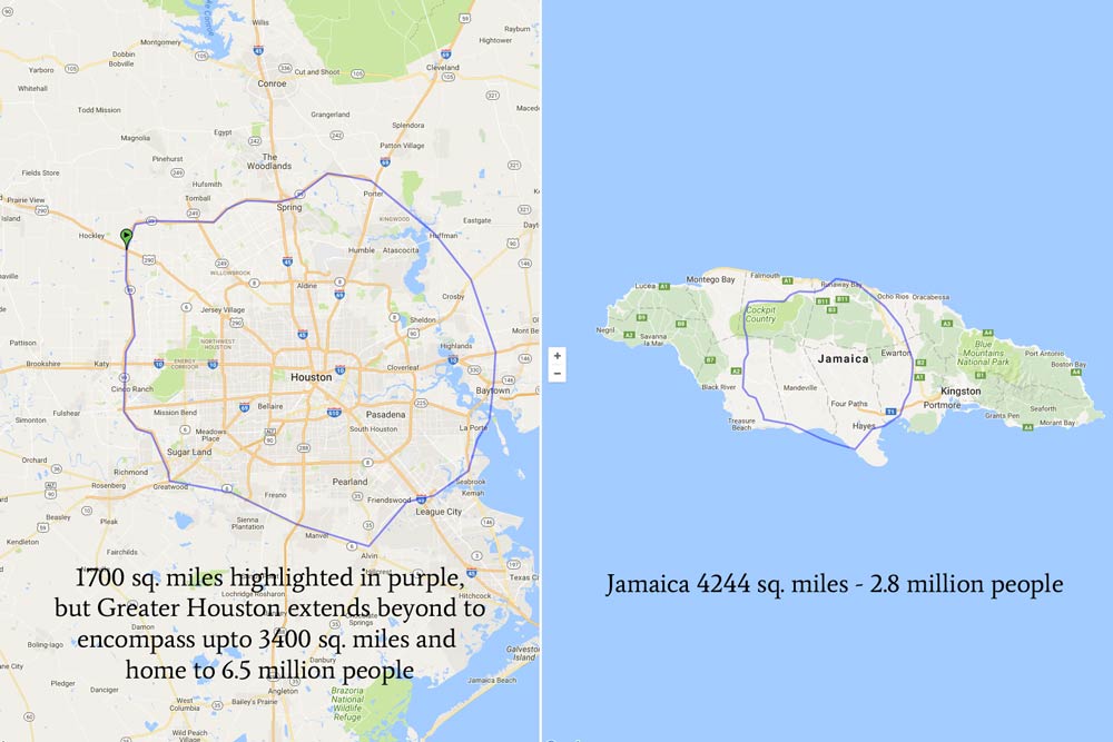
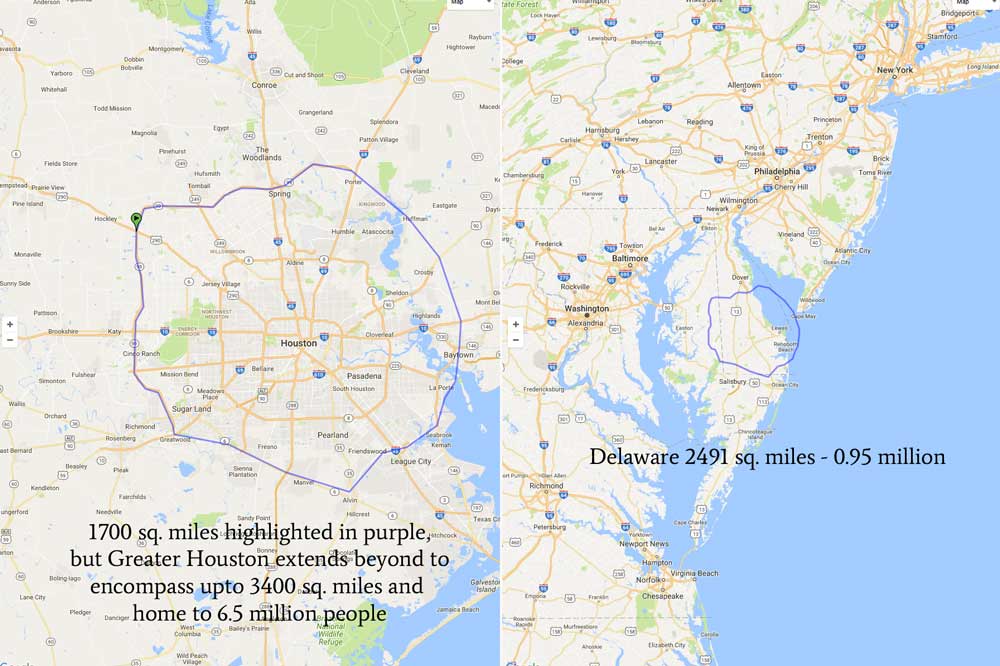
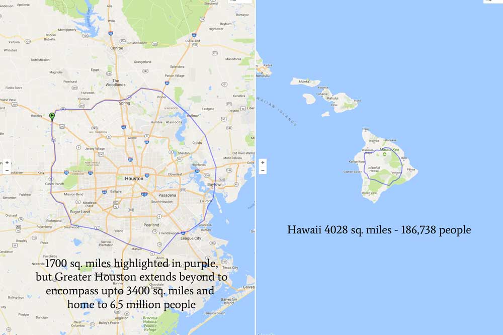
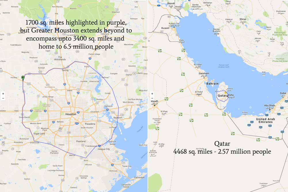
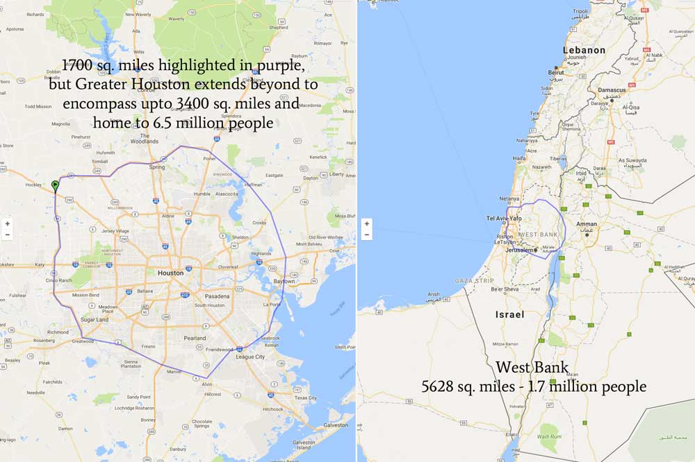
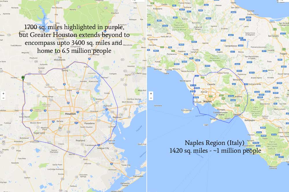
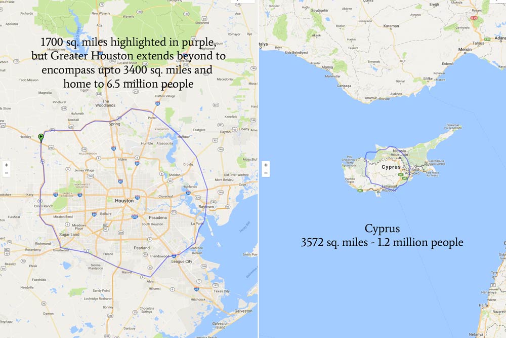
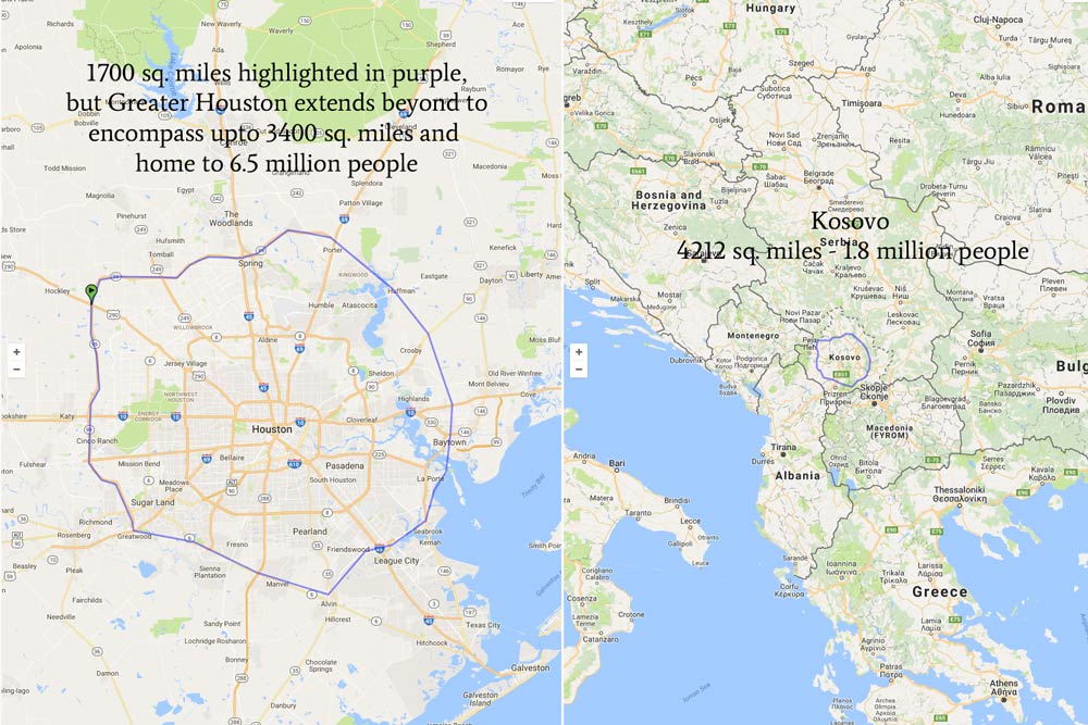
For those of you who are out of town let’s get some perspective. The Greater Houston Area is more than 1700 square miles. If you check out this little map I made below, the shaded part is just the part inside of our outer loop, SH-99 (we have three) – and the Houston area goes well beyond that loop. We service all the way down to Galveston, out east to Baytown, north to Conroe, and west to Katy. This area is tantamount to all of Delaware or Northern Ireland. Our metro area is home to around 6.5 million people (ref), Delaware and Northern Ireland house less than 1 million and around 1.8 million, respectively. P.S. There’s also been some chatter about why people would want to live somewhere that is prone to hurricanes (I don’t know of any perfect places)
P.S. There’s also been some chatter about why people would want to live somewhere that is prone to hurricanes (I don’t know of any perfect places) but I think you should ask the all the people who keep on coming. In the last census, our population increased by 25% (compared to 13% nationally). It’s probably because awesome is as awesome does – just learn to swim and prep.